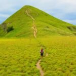
Rinjani, Trekking is easily one of the most breathtaking, rewarding, and awe-inspiring volcanic experiences you can find anywhere in Southeast Asia. Towering majestically over the tropical island of Lombok at an impressive height of 3,726 meters above sea level, this magnificent active volcano demands absolute respect from every hiker who dares to challenge its slopes. Conquering its rugged terrain is a true bucket-list adventure, but it is certainly not a walk in the park.
Once you have meticulously packed your essential hiking gear, finalized your travel itinerary, and dedicated weeks to prepping your physical fitness, you will face the next big critical question: deciding exactly which trail to take. The gateway you choose will completely define your journey, dictating everything from the daily physical challenges you face to the stunning landscapes that will unfold before your eyes.
Fortunately, the beautiful island of Lombok offers three major officially managed gateways for an unforgettable Rinjani trekking adventure: Sembalun, Senaru, and Tetebatu. Each of these official routes offers a completely different landscape, distinct difficulty levels, unique microclimates, and an entirely diverse overall experience on the mountain. Let’s break down these 3 best options in full detail so you can easily choose the perfect Rinjani trekking route that matches your personal adventure style, endurance level, and dream vacation goals.
If your ultimate goal during your Rinjani trekking tour is to stand on the actual summit of Mount Rinjani, the trail starting from Sembalun is the most popular choice. Located on the eastern side of Lombok, this route starts at a higher elevation (around 1,156m), giving hikers a slight head start in altitude.
The Landscape: The journey begins with a trek through vast, wide-open golden savannahs under the sun. As you push higher, the terrain transitions into steep, sandy slopes leading up to the Sembalun Crater Rim.
The Vibe: Energetic and highly social. Because it is the primary launchpad for the midnight summit attack, it is a great place to meet hikers from all over the world.
Best For: Hikers determined to reach the highest peak and photography enthusiasts who love wide-open landscape views.
For complete details on the itinerary, scheduling, and standard operational costs for this specific path, you can read more about the Rinjani, Trekking A Través De Sembalun route map and guidelines.
Located on the northern side of Lombok, Senaru is the oldest and most established gateway for a Rinjani trekking expedition. Starting at roughly 600 meters above sea level, it features a much heavier incline right from the beginning compared to the eastern trail.
The Landscape: This trail goes under the cool canopy of a dense, tropical monsoon rainforest, keeping hikers shaded from the direct sun, though the damp tree roots can be slippery. Once breaking through the tree line, hikers are rewarded with a dramatic view of the Segara Anak crater lake.
The Vibe: Peaceful, mystical, and close to nature.
Best For: Trekkers who prefer shaded jungle hikes over open sun, or those opting for a shorter “Rim Only” mountain experience.
To better understand the logistics, safety parameters, and preparation needed for the northern jungle trail, you can examine the official Rinjani, Trekking A Través De Senaru technical breakdown.
For hikers looking to avoid the main crowds and experience a quieter, more remote side of the mountain, the southern slope gateway provides an alternative option. This newer trail is less frequented by mass tourism, offering a more untouched wilderness environment.
The Landscape: The route begins by passing through local agricultural fields and a black monkey forest before entering dense, tropical jungle. The terrain is characteristically steep and raw, demanding good physical stamina as it leads up to the southern crater rim, which reveals a different viewing angle of the summit and Segara Anak lake.
The Vibe: Remote, quiet, and physically challenging.
Best For: Experienced trekkers, independent travelers, and those preferring a more isolated mountain environment.
Detailed information regarding the specific itinerary, terrain characteristics, and navigation maps for this route can be found directly on the Rinjani, Trekking A Través De Tetebatu section.

| Feature | Sembalun Route | Senaru Route | Tetebatu Route |
| Primary Attraction | Direct Summit Attack | Best Crater Lake Views | Wild Jungle & Isolation |
| Difficulty | Moderate to Hard (Sandy Summit) | Strenuous Incline | Challenging & Raw Terrain |
| Shade/Cover | Very Low (Open Savannah) | High (Deep Rainforest) | High (Jungle & Monkey Forest) |
| Crowd Level | High | Medium | Very Low (Hidden Gem) |
Selecting a starting point is the first step in organizing an expedition. Depending on individual time constraints and physical preparation, each route supports different itineraries, commonly ranging from a short 2 Days 1 Night rim trek to a 3 Days 2 Nights or 4 Days 3 Nights full-loop journey.
To evaluate how each trail fits into different timelines, group logistics, and seasonal regulations, you can review the specific operational structures for each route:
For the eastern summit track, detailed scheduling is listed on the Rinjani, Trekking A Través De Sembalun technical resource.
For the northern rainforest path, logistics are outlined on the Rinjani, Trekking A Través De Senaru guide sheet.
For the southern wilderness trail, terrain updates are available on the Rinjani, Trekking A Través De Tetebatu documentation page.
A comprehensive breakdown of standard service inclusions, seasonal availability, and gear checklists can be found when planning and booking Rinjani trekking with 17 Tour Agency through our main informational portal.
Oferta Especial Sólo Para Usted !
Vea Nuestro Vídeo en YouTube
Chat Con Nosotros En